1. Olperer Hütte (Olperer hut)
Starting point: Zamsereck Length: 7.64 km Duration: 3 hours Difference in altitude: 610 m
This hike is now probably one of the most famous in Austria. At least since the photos of the famous suspension bridge with the Schlegeis reservoir in the background made it onto Instagram, thousands of visitors have been romping here every day. Nevertheless, we can highly recommend this moderately difficult hike, you can find a detailed report HERE.
Another well-known hike in the area is the “Neumarkter Runde”, a very scenic mountain hike on well-laid paths.
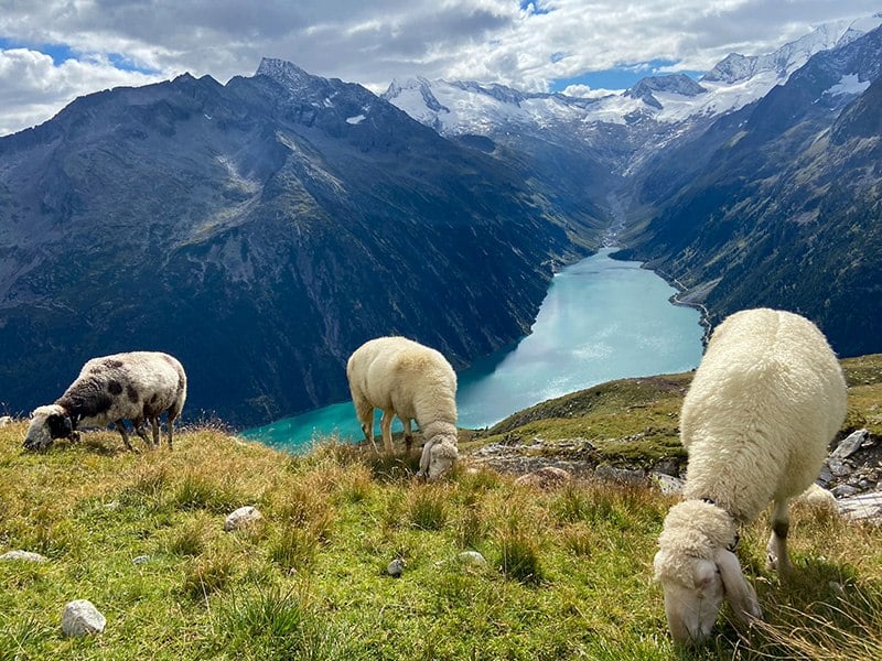
2. Berliner Hütte (Berliner hut)
Starting point: Gasthaus Breitlahner Length: 8.6 km Duration: 3 h Difference in altitude: 785 m
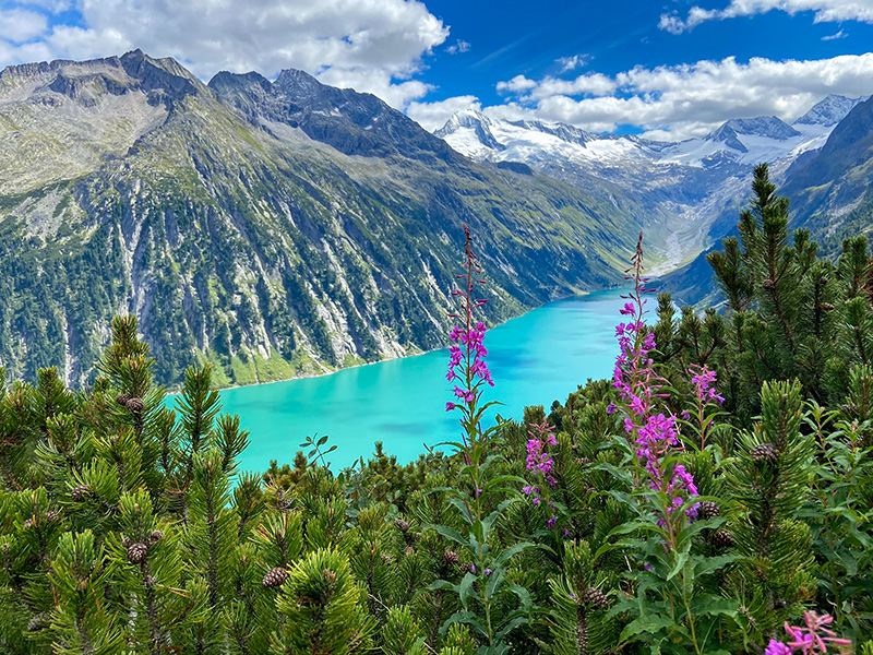
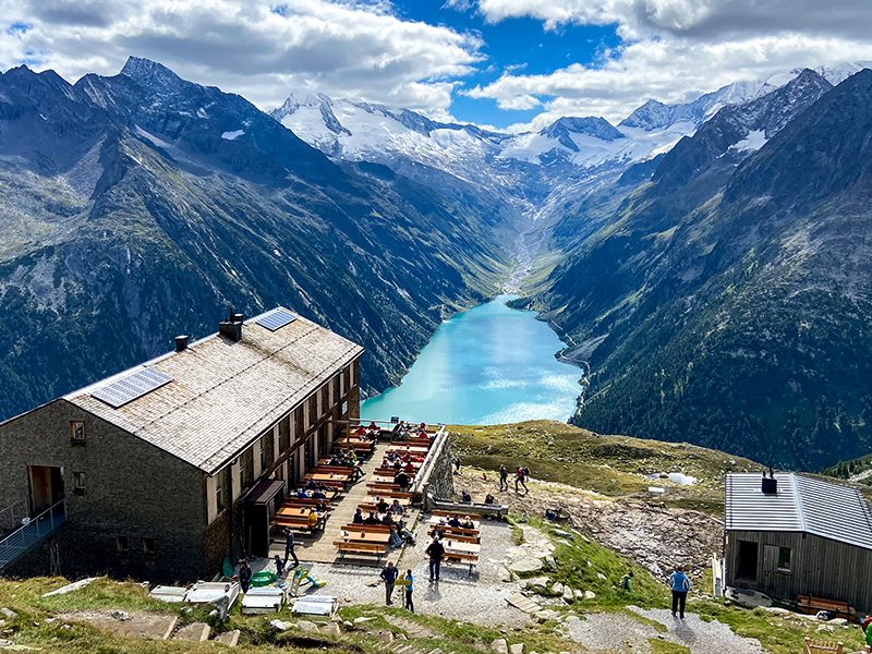
A real classic is the ascent to the Berliner Hütte. We park at the Alpengasthof Breitlahner. From there we go down to the bridge in the Zemmtal and hike left into the valley. You get through the wide basin with the Schwemmalm, from here it is a little steeper up to the Grawandhütte (1636 m). Through a piece of forest it goes up to the open areas of the Grawandalm, past a small parking lot to a small hut with barriers in front of it. On a concrete road it goes on over the Zemmschlucht to the Alpenrosenhütte (1878 m)
A few meters after the Alpenrosenhütte, the signposted mountain path branches off to the left to the Berliner Hütte, which is at 2042 m. Incidentally, the Berliner Hut is now a listed building and offers 180 beds
3. Steinbockmarsch
Starting point: Ginzling Length: 30 km Duration: 8.5 hours Difference in altitude: 3,484 m
The annual ibex march or run is a real event. The march leads over high alpine terrain over a length of 30 kilometers. The ascent is 1871 meters in altitude, a total of almost 3,500 meters in altitude are overcome. Only for experienced hikers! Register here: zillertaler-steinbockmarsch.com
4.Round around the Durlaßboden reservoir through the magic forest
Starting point: bus station Gerlos Alpenstausee Durlaßboden Length: 11 km Duration: 3 hours Difference in altitude: 130 m
Even from the dam you have a clear view over the reservoir or down to the Gerlos pass road into the valey. After 2.2 km you come to the very idyllic magic forest. During the hike, you always have a view of the reservoir. Several benches invite you to rest. It goes on and on around the lake. After approx. 10 km you come to the lush, sunny meadow Durlaßboden, which invites you to take a break.
5. Hike on the Ahorn
Starting point: Mayrhofen Length: 8.21 km Duration: 3:20 hours Difference in altitude: 520 m
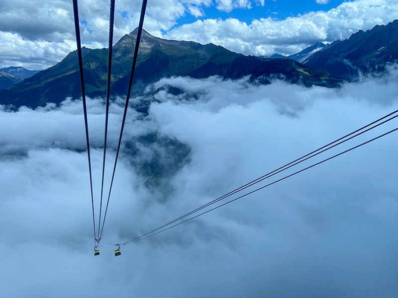
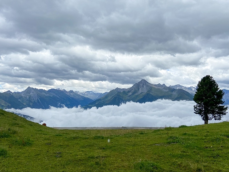
The cable car takes you from Mayrhofen to the top of the mountain station. The pleasure trail, which runs across the entire Ahorn plateau, is suitable for pushchairs and is a special experience for young and old! The circular route provides information about the diverse flora and fauna of the high mountain nature park Zillertal Alps.
After 240m you come to the Ahorn platform, which impresses with a breathtaking panorama and distant view.
After 3km you come to the Edelhütte, where you can relax and unwind. At km 5.8 you come to the Ahorn plateau. Another highlight follows after 7.6 km, the Ahornsee. The lake is a perfect stop to rest. There are numerous play options for children. In addition, the lake is cordoned off by a fence to protect it from wild animals. In midsummer it can get very crowded here. However, there was no danger of this during our visit 😉
After almost 8 km you come back to the Adlerblick viewing platform on the Ahorn, where you have a wonderful view of the Zillertal.