


Short info:
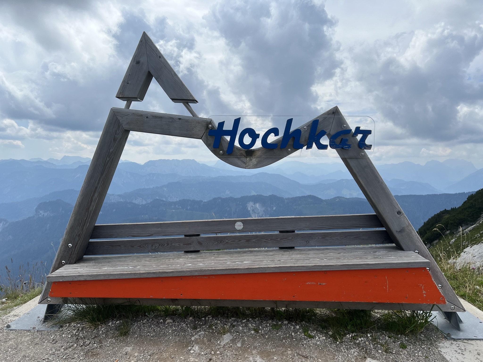
- What is the Hochkar? The Hochkar is a 1808 m above sea level. A. high mountains of the Ybbstal Alps on the border of Lower Austria and Styria.
- Where is it located? You can find the valley station at the following address: Lassing 48, 3345 Hochkar
- What are the highlights? The 360˚ sky tour, hike to the Hochkar summit cross and many other worthwhile hikes.
- When are the chairlift operating hours and how much does it cost? Here you will find the prices and operating times for summer and winter.
Due to its proximity, the Hochkar is a very popular ski area, especially among the Viennese. With around 20 km of slopes and nine lifts, including six chair lifts, it is the most important winter sports area in Lower Austria.
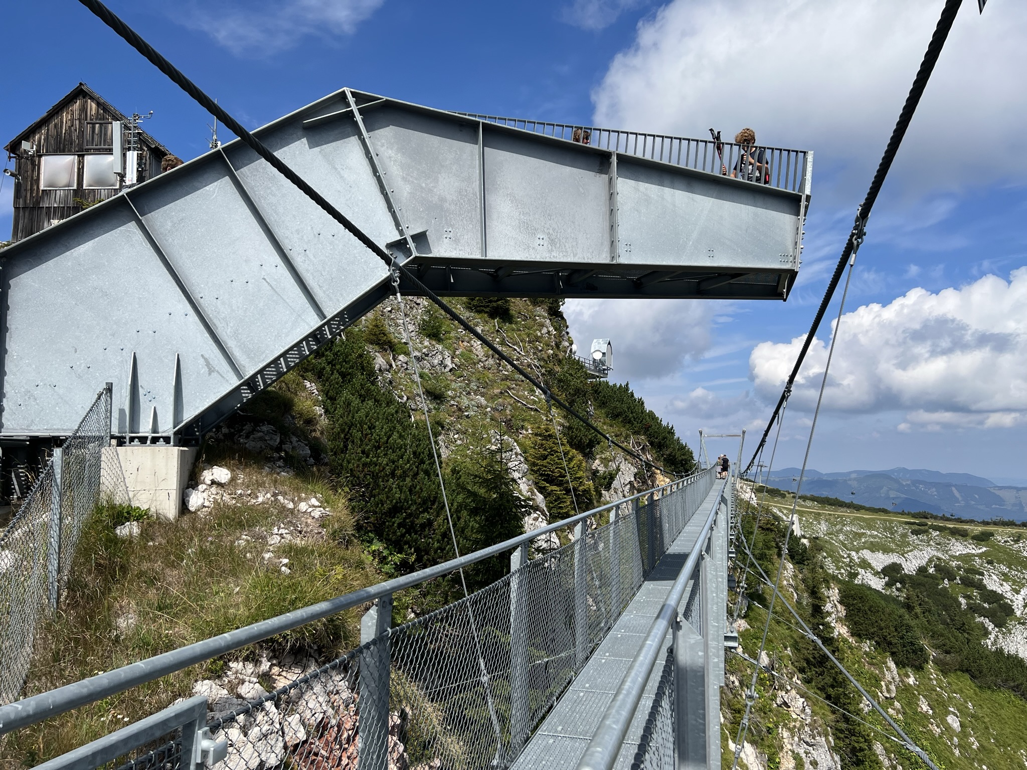
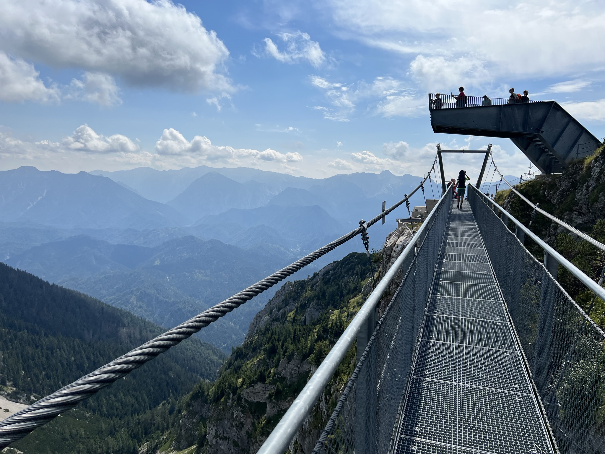
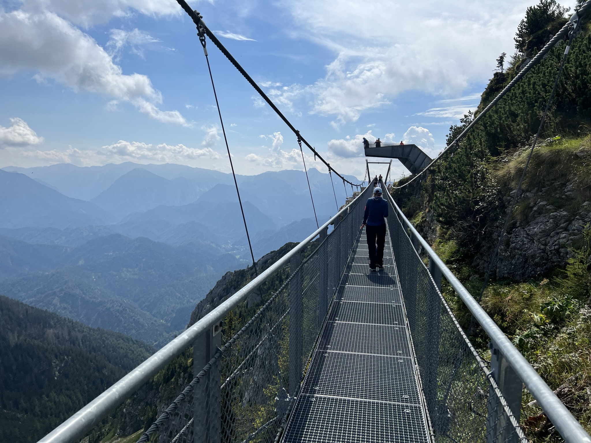
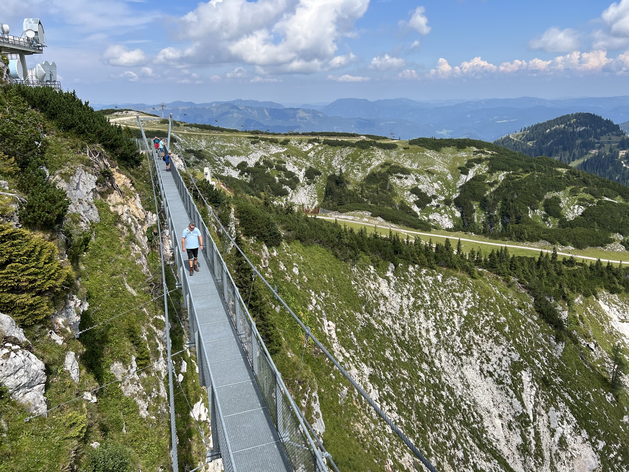
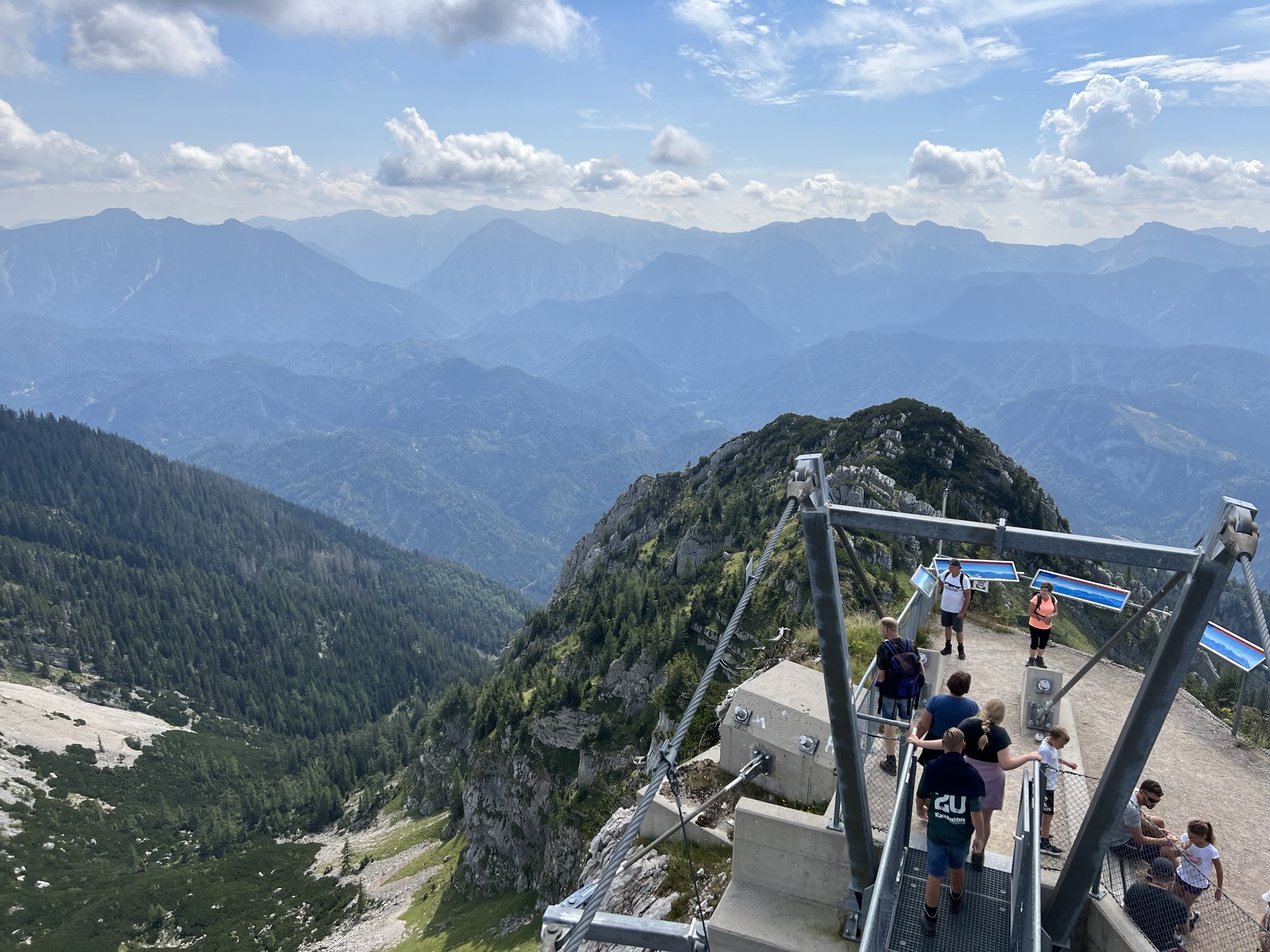
Since June 2015 at the latest, the mountain massif has also been very popular in summer, when the 360° Skywalk opened. Made of steel, highlights include a 60-metre-long suspension bridge and a viewing platform that juts 8.5 meters over the rocks and hovers 120 meters above the chasm at the top.
Reason enough for us to visit the Hochkar in summer.
A little tip: be sure to check the weather beforehand. A viewing platform is little fun when clouds hang in the peaks.
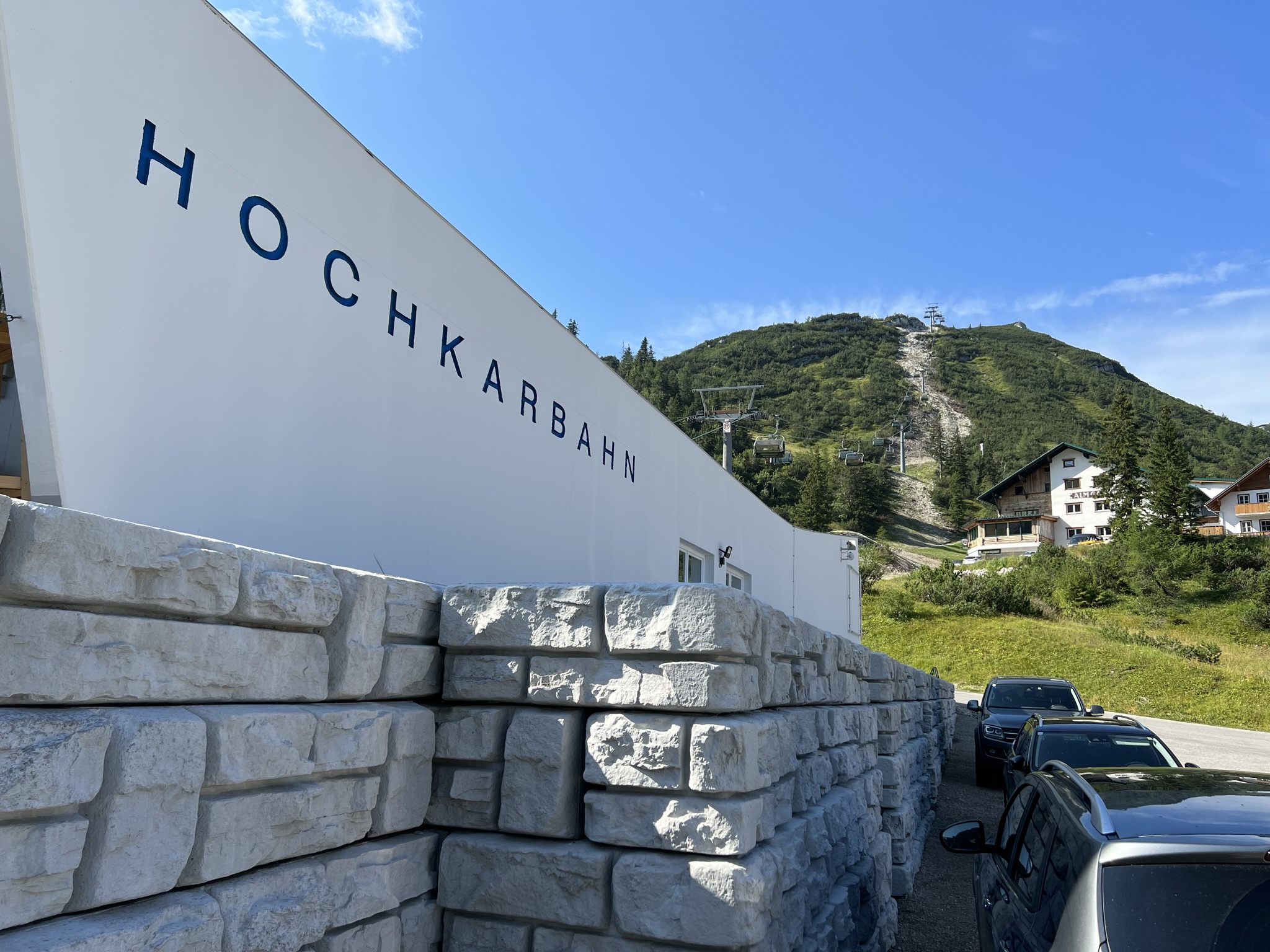
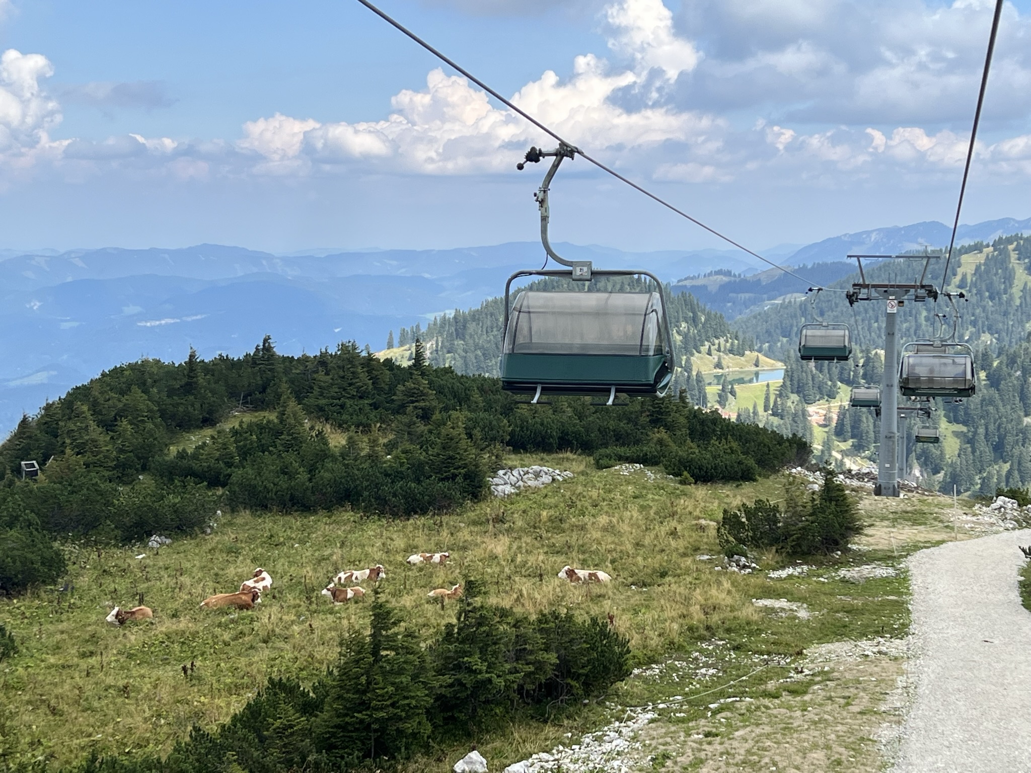
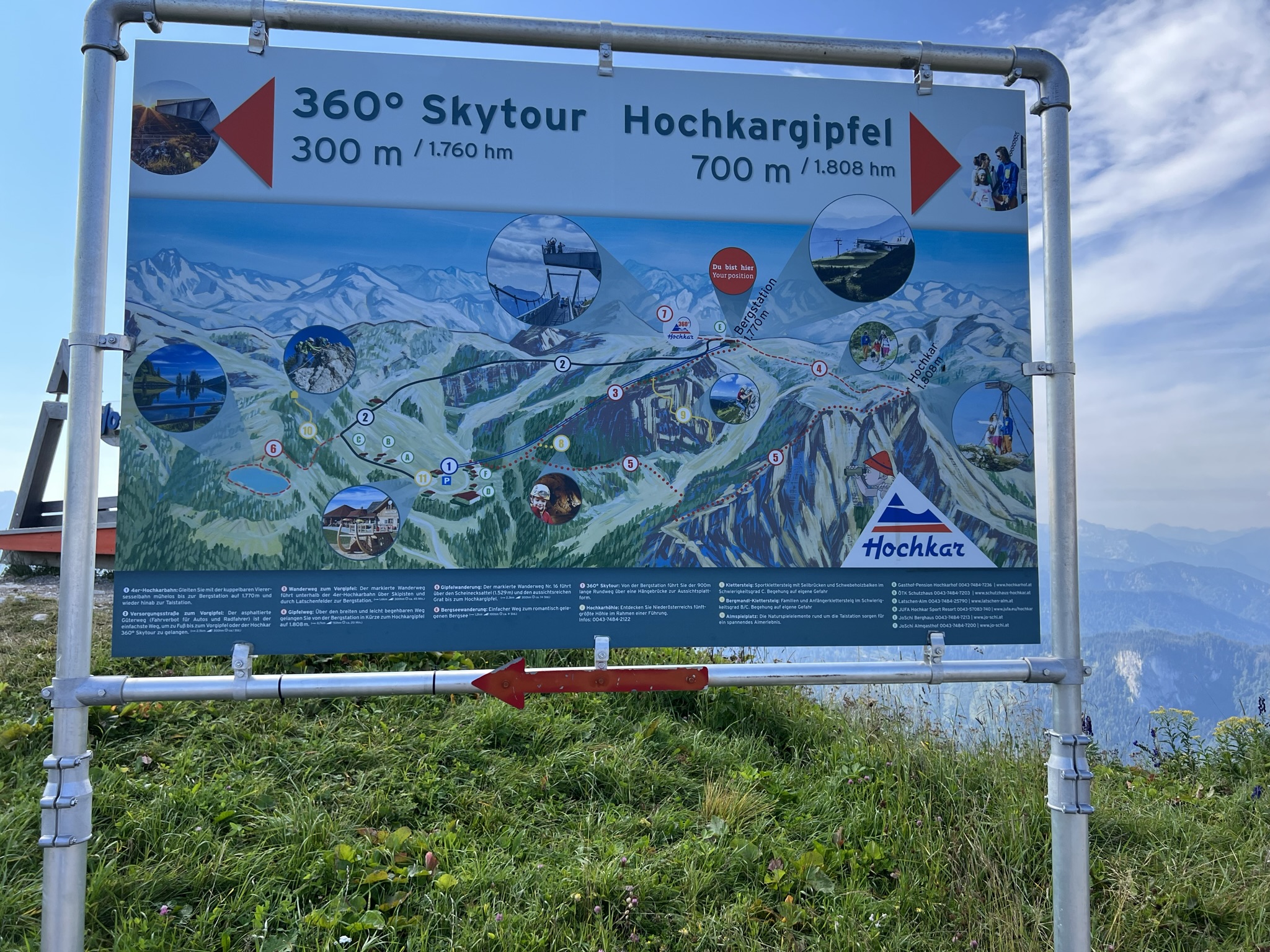
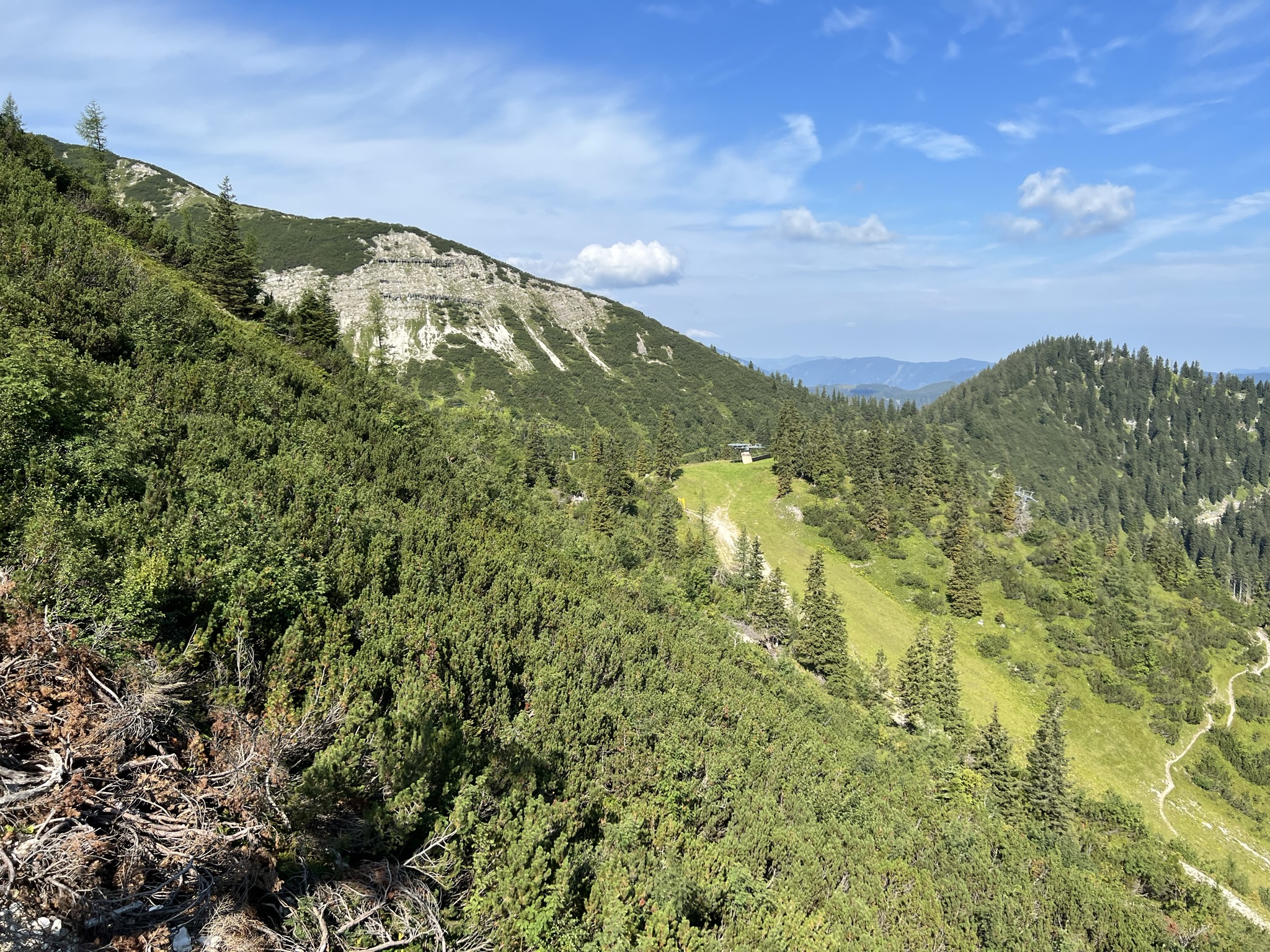
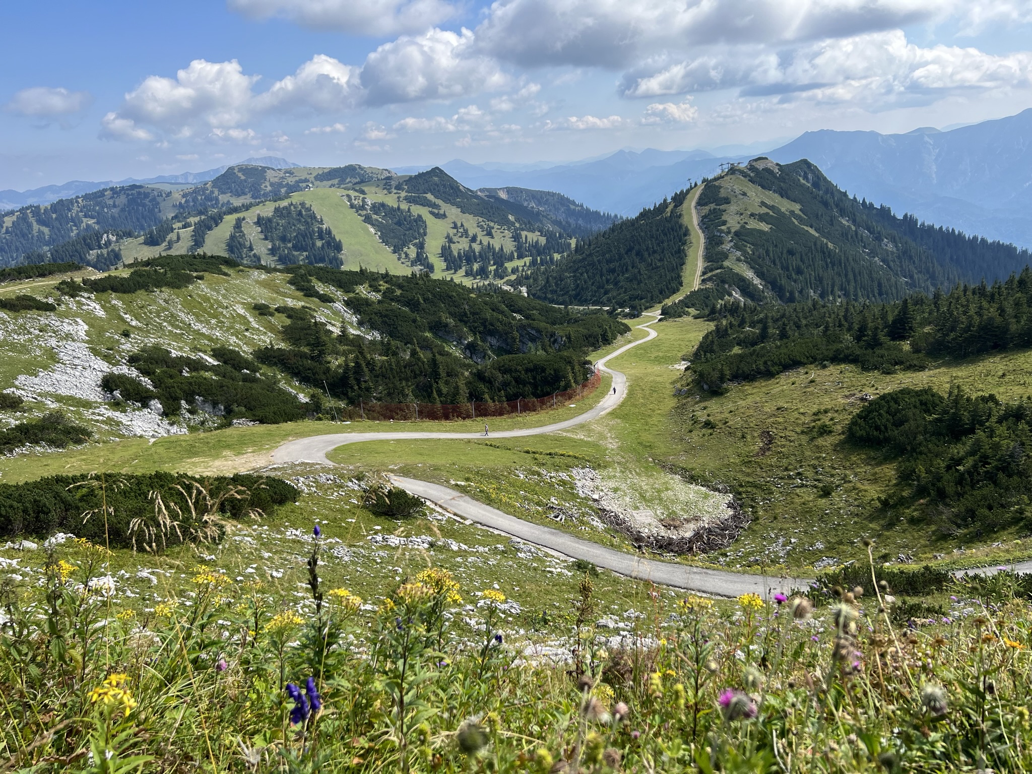
At 10:00 a.m. we park at the valley station of the cable car. From here you continue with the 4-seater Hochkarbahn. The ride costs 21 €, but we have our Niederösterreich Card with us again, with which the ride is free once. In about 10 minutes you are at the mountain station at 1,770 m.
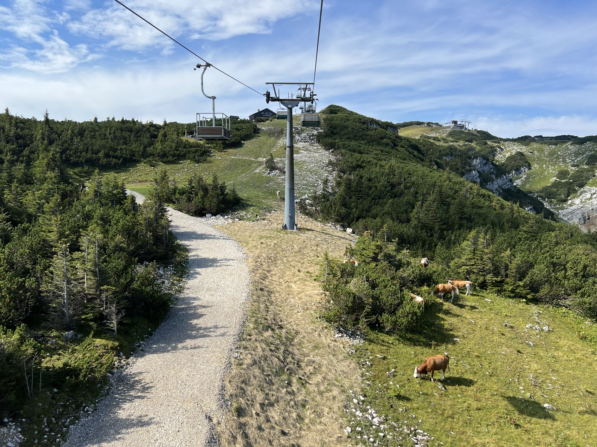
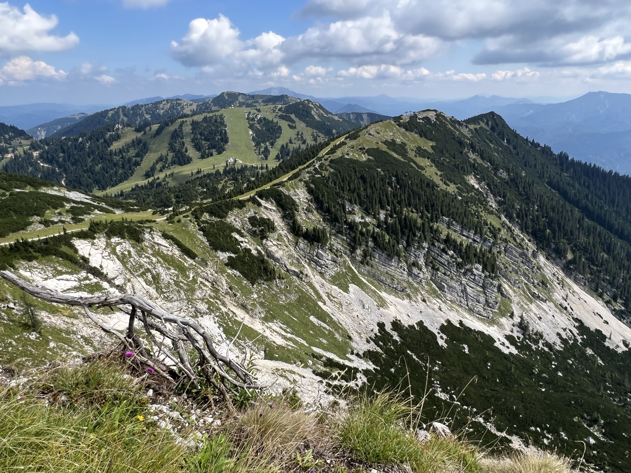
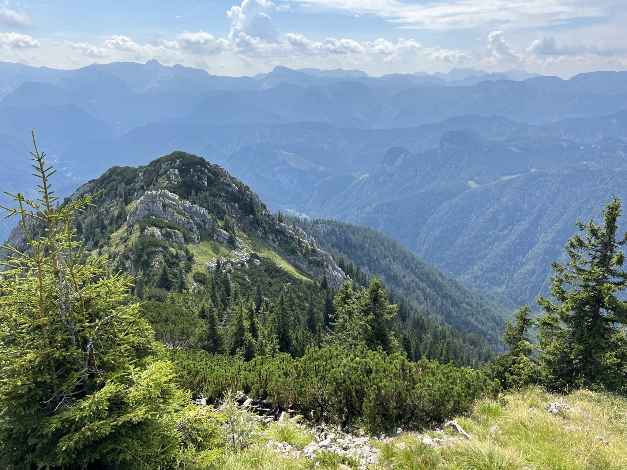
From here there are 3 very popular destinations, namely the Hochkar summit cross, the impressive 360˚ sky tour and the hike to the mountain lake.
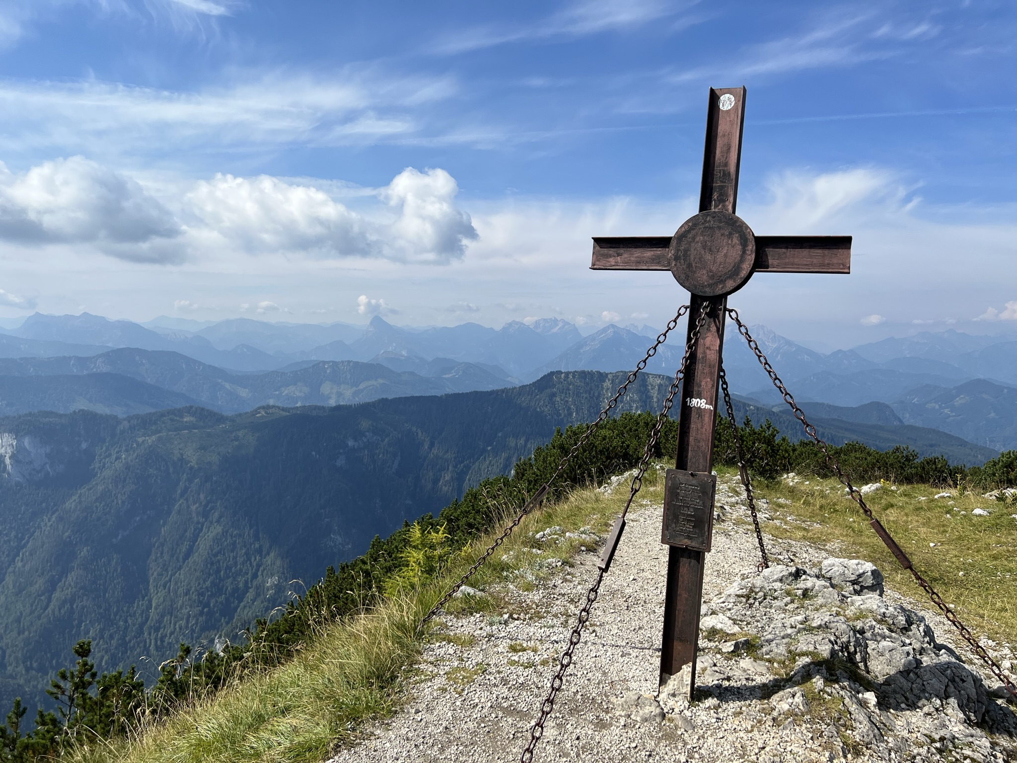
Hike to the Hochkar summit cross
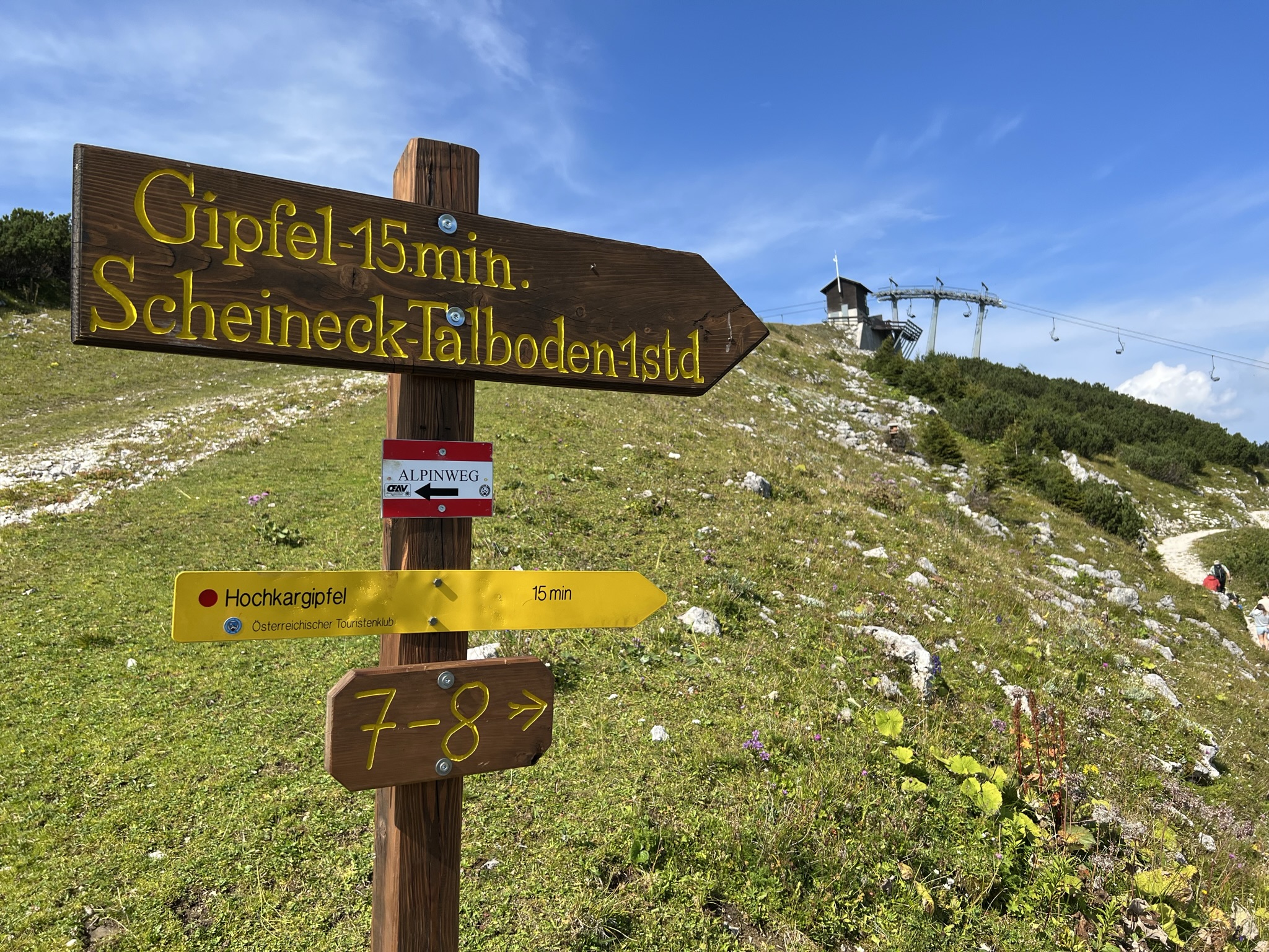
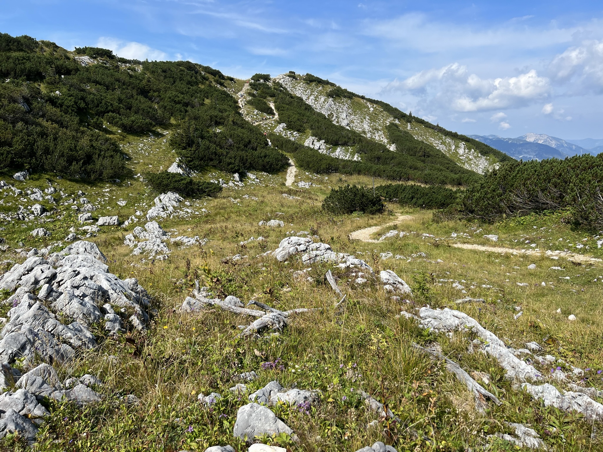
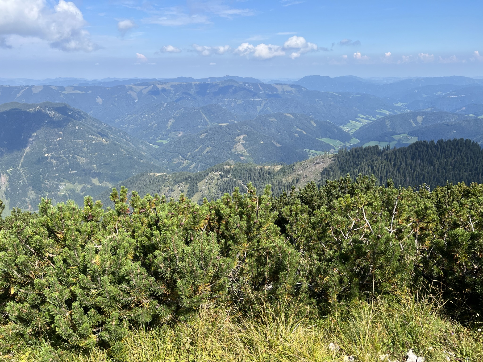
You will hardly find an easier way to call yourself a summiteer. From the mountain station you can already see the summit cross on the right-hand side. The way up takes about 15 minutes on foot and is popular with both young and old, as it really does not require any special physical condition. We easily made the trail with our 3 year old. The path is well secured and practically harmless. Towards the slope, the rocks are overgrown with pines.
Accordingly, it can get crowded at the summit cross. If you can’t find a place at the 2 picnic benches, you can always sit on a stone to rest.
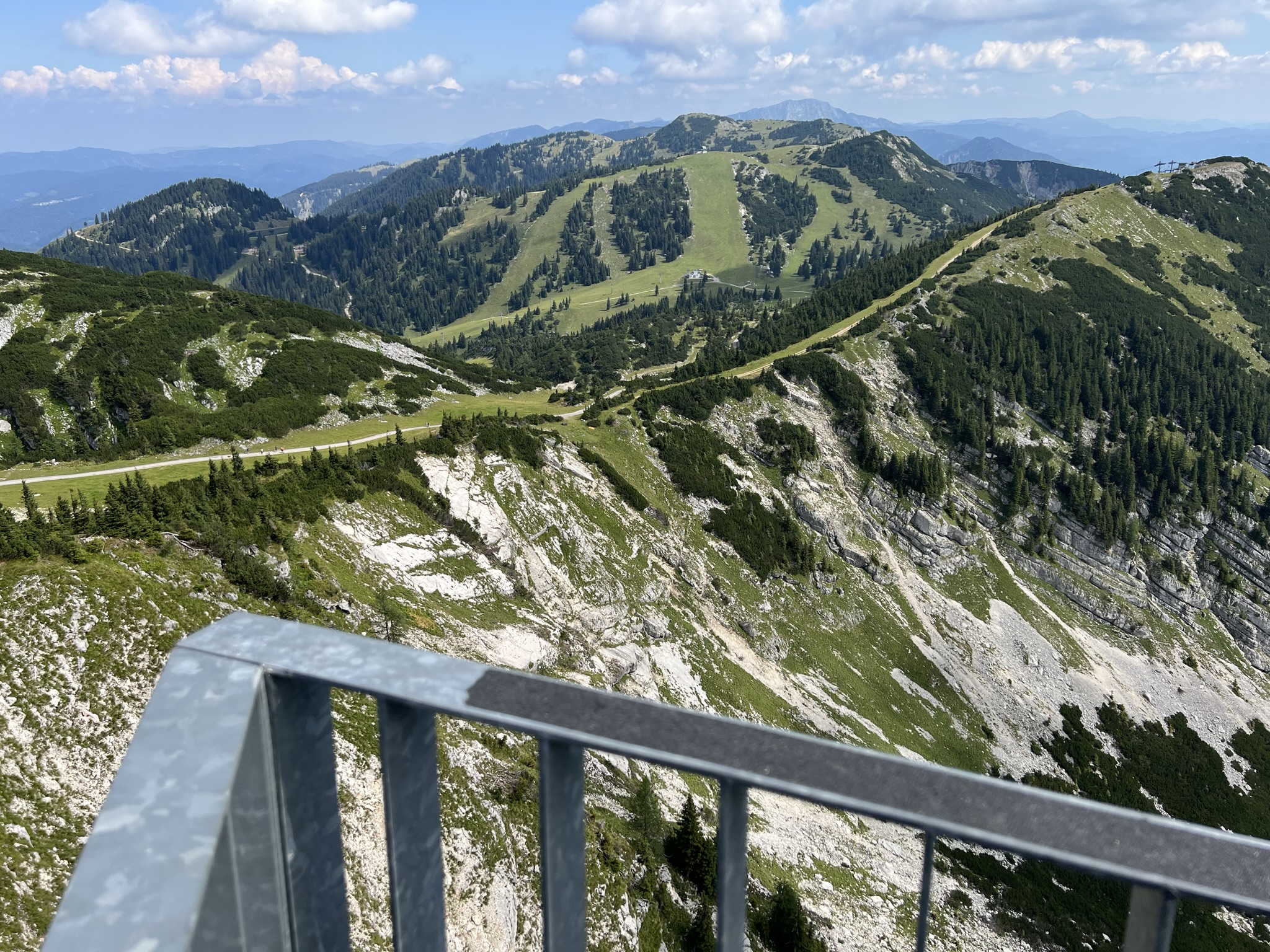
360˚ sky tour
To get to the well-known viewing platform, you have to go left from the mountain station. The round trip is about 900 meters. Don’t be confused, you can’t see them from there, but Lower Austria’s highest viewing platform is behind the transmission mast. It only takes about 10 minutes to get there – first down a concrete path and at the end uphill over steps to the 60 meter long suspension bridge.
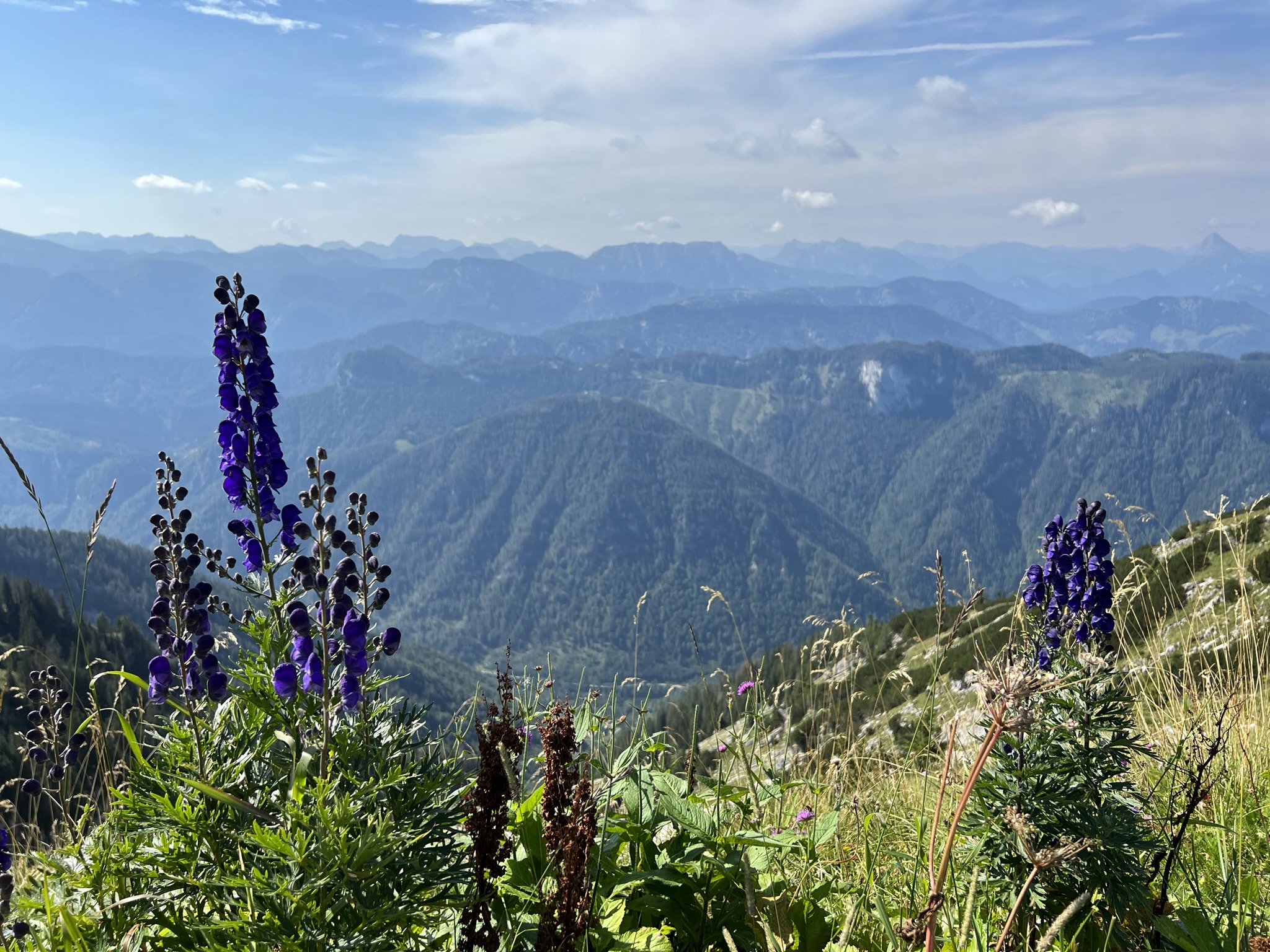
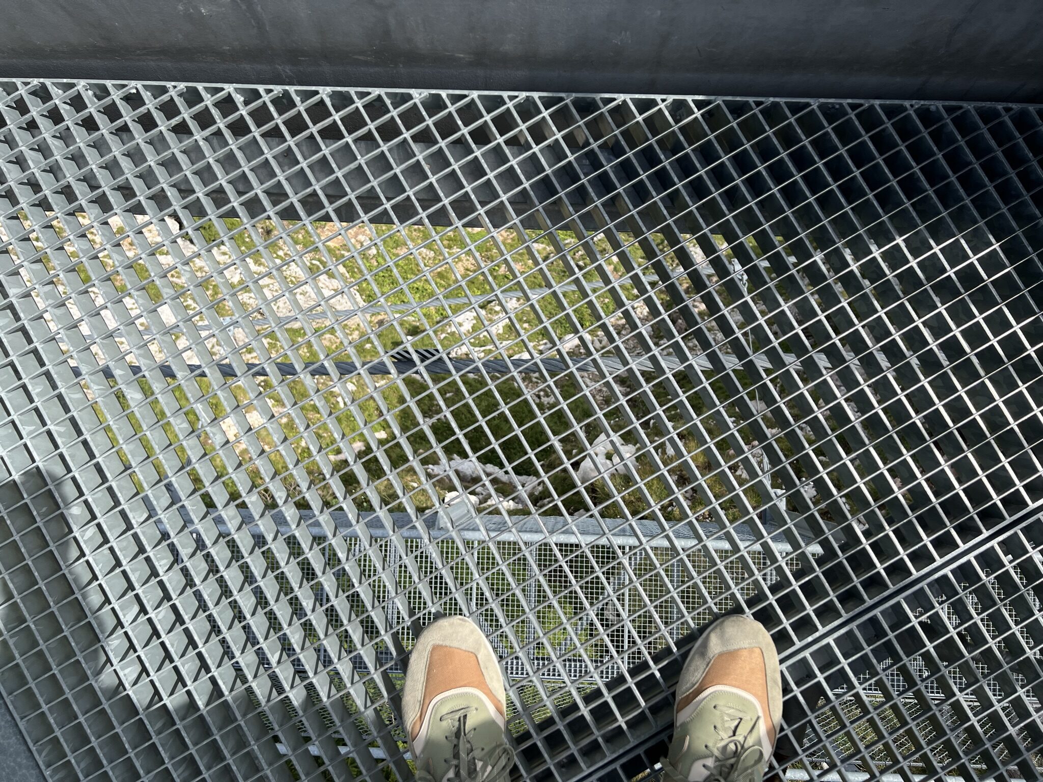
You should have a head for heights for the suspension bridge, as you can see through the grating down to the 120 meter deep abyss. But don’t worry, absolutely nothing can happen, it’s very well secured. After the suspension bridge you will already reach the first natural lookout point on the mountain. Even from here you have a breathtaking view over the Danube or into the Styrian mountains. From here we continue to the constructed viewing platform at 1,760 meters above sea level. From here the view extends from the Mostviertel over the Danube valley to the Waldviertel and Weinviertel in the north, in the east from the Dürrenstein over the Hochschwab massif to the Dachstein massif in the west. From here you have a view of over a hundred 2000m peaks!
From the valley station to the mountain lake
Another recommended hike is this 30-minute tour to the mountain lake, which can even be managed with a pram. Once you have reached the forest road, you hike through the forest past the Latschen-Alm to the crystal-clear mountain lake.
