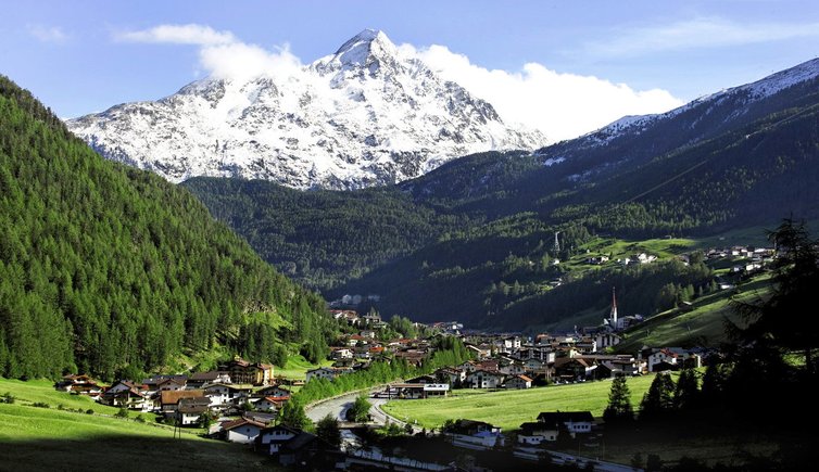
Soelden is the largest municipality in Austria, with an area of 468 km² in the southern part of the Ötztal in the district of Imst, Tyrol. Sölden lies at an altitude of 1368 m above sea level.
With almost two million overnight stays per year and 15,000 guest beds, Sölden is an important tourist area, mainly for winter sports. The former character of a mountain farming village, which was prevalent throughout the Ötztal until the second half of the 20th century, was lost and replaced by a tourist-alpine architectural style.
In the south of Sölden, the cable car starts up to the Gaislachkogel up to 3058 m Height. From the Söldner district Pitze The 13 km long Ötztal Glacier Road branches off to the Rettenbachferner ski area and via the highest tunnel in the Alps to the Tiefenbachferner.
Above the valley lies at about 2083 m above sea level. A. the hotel complex Hochsölden, which is connected to the valley by a road and a cable car. Above Hochsölden is the Giggijoch ski area. The Berghof is located at an altitude of 1435 m above sea level. A. north of the Rettenbach, directly above the center of Sölden.
Tourist infrastructure in winter
The Sölden ski area, which also includes two glaciers (Rettenbachferner and Tiefenbachferner), has 39 cable cars and 146 kilometers of slopes. The main part of the ski area is at an altitude of over 2,000 m and reaches a height of over 3,000 m in three places. The highest point accessible by lift is at an altitude of 3,250 m.
Furthermore, an open-air theater and the FIS Ski World Cup take place annually on the Rettenbach glacier, see Alpine Ski World Cup in Sölden.
In 2010, the 17-meter-deep, 416,500 m³ “Panoramasee” became Tyrol’s largest artificial storage pond for snowmaking systems.
Overview of Sölden’s tourist infrastructure:
- 39 cable cars (from 1377 to 3250 m)
- 148.3 km of slopes (including 61.5 km of blue, 58.3 km of red and 31.1 km of black slopes, as well as 6 km of ski routes)
- three cross-country ski trails (16 km)
- illuminated toboggan run
- illuminated ice rink
- Swimming pool, tennis hall, sports arena
- 38 ski huts
- 2 fun parks (Tiefenbach/Giggijoch)
Tourist infrastructure at a glance (Obergurgl/Hochgurgl):
- 23 cable cars (from 1800 to 3080 meters)
- 110 km of slopes (including 35 km blue, 55 km red and 20 km black slopes, ski routes)
- 36 km cross-country ski trail
- illuminated ice rink
Tourist infrastructure at a glance (Vent):
- 4 cable cars (from 1900 m to 2680 m)
- 15 km of slopes (including 5 km blue, 10 km red, ski routes)
- 4 km cross-country ski trail
Tourist infrastructure in summer
- Gaislachkogel cable car at the summit
- Venter Höhenweg from Gaislachkogel towards Vent
Summer tourism in Sölden is mainly characterized by mountain hiking and high alpine mountaineering. In addition to the numerous alpine pastures, there are 16 high alpine refuges, most of which belong to sections of the German Alpine Association.
Tourist infrastructure at a glance:
- 300 km of hiking trails
- Cycle paths (forest paths)
- Via ferrata, climbing garden
- Tennis court, indoor swimming pool


