


Quick Info:
- Where is the Zireiner Lake located? In the Rofan Mountains, Tyrol
- Can you reach it by car and is there parking available? No, there is no road leading up to it.
- Is swimming allowed in the lake? Yes, but the water is usually quite cold.
- How deep is the lake? 5-10 meters
Overview
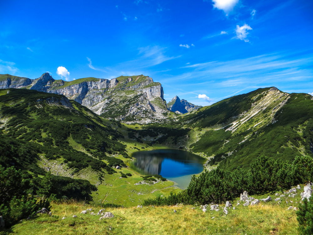
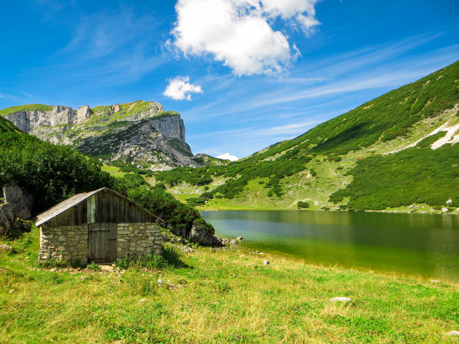
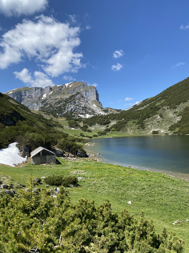
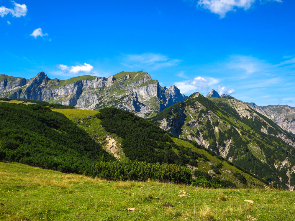
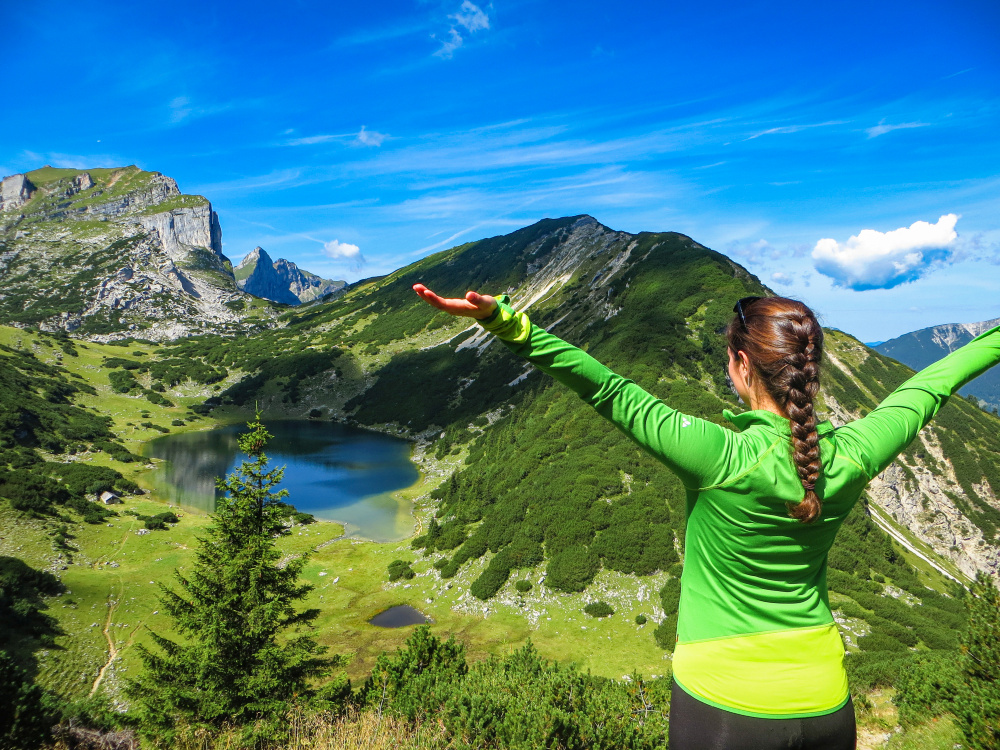
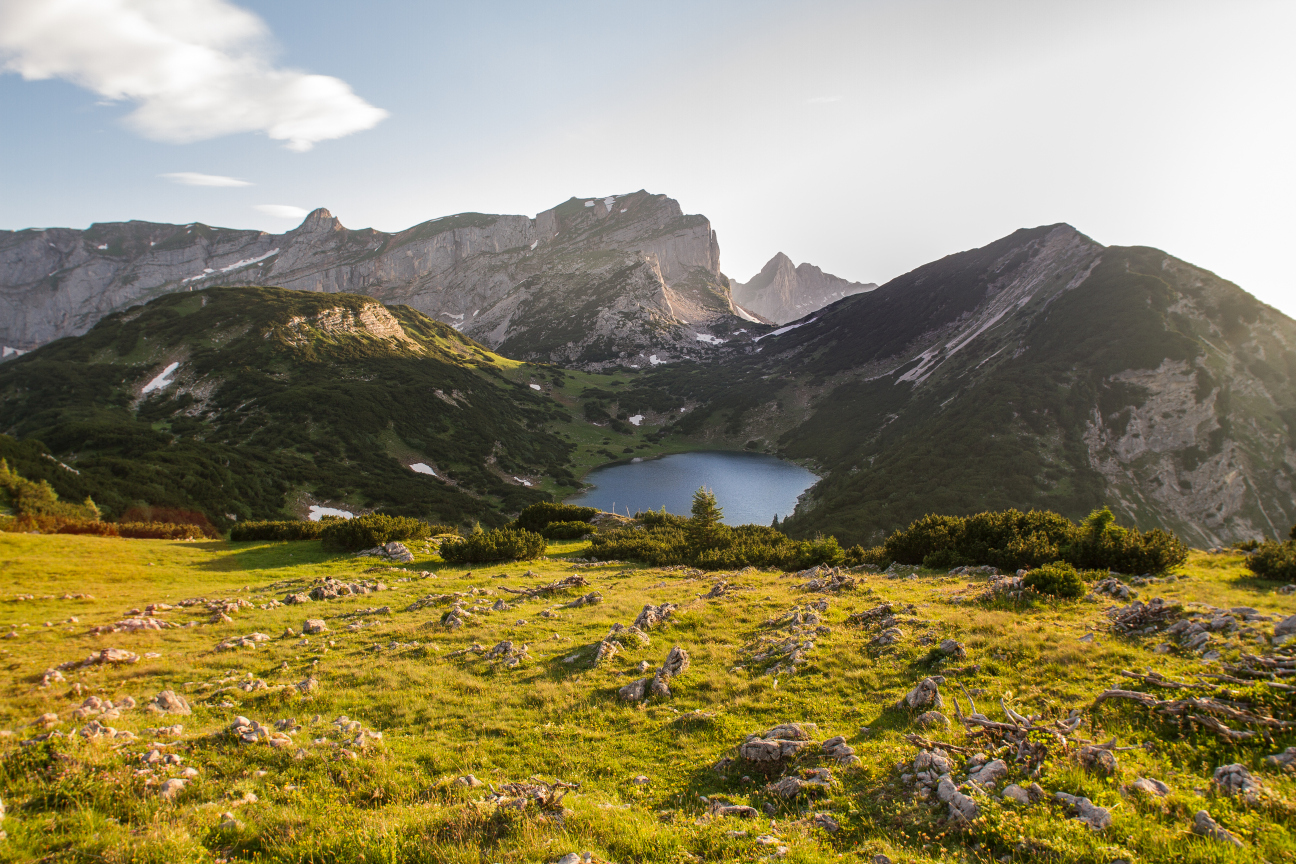
In the impressive Rofan Mountains lies an absolute highlight, the Zireiner Lake, also known as the “Blue Eye of Rofan.” It is situated at an altitude of 1799 meters on a sunny plateau. This mountain lake is undoubtedly one of the most beautiful in all of Tyrol. Nestled between the imposing Rosskogel and the majestic Rofanspitze, the Zireiner Lake offers a picturesque backdrop. The color of the lake varies depending on the weather, enhancing its fascination even more.
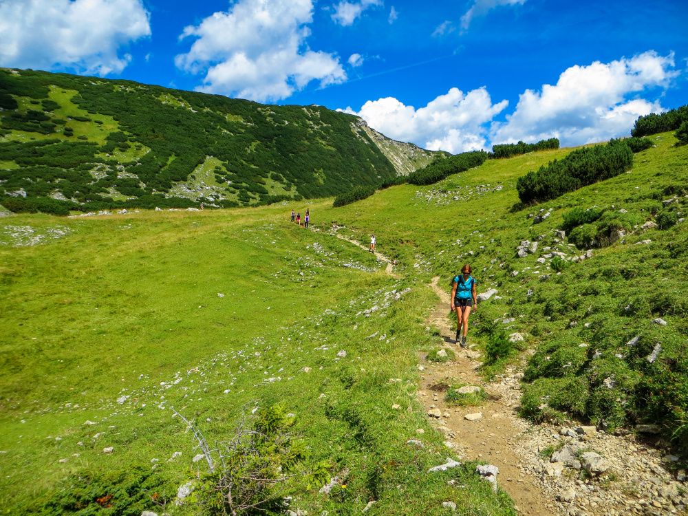
The ascent to Zireiner Lake rewards hikers with breathtaking panoramas; on clear days, you can even spot the imposing Grossglockner in the distance. This tour requires good physical condition, but the path itself is relatively straightforward. However, the efforts are generously rewarded with the beauty of the lake and the surrounding mountain scenery.
How to Reach the Lake
There are several ways to hike to the beautiful Zireiner Lake, and although the routes are challenging, they reward you with stunning views. Along the way, you can recharge at rustic alpine huts.
Here are some tour tips:
1. Hike from the Aschau-Wimm Parking Lot in Brandenberg (approx. 6 hours)
The starting point of this hike is Aschau in Brandenberg. The path initially leads towards Eilalm to the charming Anderl’s Alpine Hut. From there, continue the hike over Lobeggalm and Kreuzein-Hochleger to Rosskogelsattel. Soon, you’ll reach the desired destination of the hike – the enchanting Zireiner Lake at an elevation of 1,799 meters. The lake is beautifully nestled between Rosskogel (1,940 meters) to the east and the majestic Rofanspitze (2,259 meters) to the west. It’s worth mentioning that the European Long-Distance Trail E4 also passes through here.
For the return, follow the same route as the ascent. This popular route offers a beautiful and varied path.
Duration: 6 hours of hiking covering a distance of 14.7 km
2. Start at the Sonnwendjochbahn Parking Lot, Kramsach, to the Lake (approx. 8 hours)
This physically demanding tour with significant elevation gain starts at the Sonnwendjochbahn parking lot, which is no longer in operation. From there, follow path No. 9 until the Kaltwasserbründl junction and continue the hike on path No. 8 to the middle station of the lift. Below the lift track, continue to the mountain station, which takes about 3.5 hours.
From Berghaus Sonnwendjoch, the path leads straight up to Rosskogelsattel and then northwards past Rosskogel over Rosswies to AV Trail 401, which descends to Zireiner Lake (about 1 hour). After ascending at the western end of the lake, you’ll reach a fork in the path. Turn left here and continue the hike towards Zireiner Alm. From there, descend briefly until you turn right onto a trail at the next hairpin bend (follow signage). This trail leads to Bayreuther Hütte and Bergalm (about 1.5 hours). Finally, descend from there to the lift parking lot in Kramsach (about 2 hours).
Distance: 17 km, Duration: 8 hours
3. E-Bike Ride along the 8 km Long Forest Road from Kramsach Liftparkplatz to Bayreuther Hütte,
The most popular option is the tour from the Liftparkplatz in Kramsach with an e-bike.
Starting Point: Liftparkplatz Kramsach, ride along the steep forest road towards Bayreuther Hütte.
After 4.8 km: At the junction, turn right towards Bayreuther Hütte.
At kilometer 6.0: At the fork, turn left uphill.
At kilometer 7.8: At the junction below the hut, turn left and continue a few more meters uphill to Bayreuther Hütte (the right path leads to the small Bergalm).
After 8.0 km: Arrival at Bayreuther Hütte.
From there, it’s about 1.5 hours of hiking to the lake.
4. Zireiner Lake from Rofan Cable Car Mountain Station (approx. 5 hours)
This more challenging route for experienced hikers to Zireiner Lake begins at the Rofan cable car mountain station, which you can reach from Eben am Achensee via gondola. The gondola ride itself is an experience as you float over Lake Achensee and enjoy the view. Within minutes, you’ll reach the mountain station between Erfurter Hütte and Berggasthof Rofan. The hike to Zireiner Lake starts from there.
At the beginning, follow the hiking signs indicating the direction of Rofanspitze. This peak lies on the way to Zireiner Lake. The hike is demanding, involving an ascent and descent of about 1000 meters in total. The key section of the tour is the very steep “Schafsteig” (sheep trail) located below Rofanspitze, leading down along a rock band. Surefootedness is necessary, and in some places, there’s a bit of exposure, so it’s not suitable for inexperienced hikers. A wire rope along the Schafsteig assists with the descent.
After a successful descent, you’ll reach Zireiner Lake, which shimmers like a blue eye amidst the gray rocks from above.